Abbotsbury
There are four RIGS sites at Abbotsbury:
World Heritage Site
The World Heritage team, led by Richard Edmonds, have been drawing up strategies for the conservation and interpretation of the geology of the Dorset coast, which is a World Heritage Site. The strategies will cover not only the immediate coast but also sites marginally inland, such as the Abbotsbury, Portesham and Poxwell sites. The team, in partnership with the Dorset’s Important Geological Sites group, are intending to use Red Lane quarry as an example of the co-operation possible between landowners and conservationists in providing greater access to the countryside, and promoting geo-tourism. Visits by geological parties are best conducted in the spring and autumn, outside the summer high season.
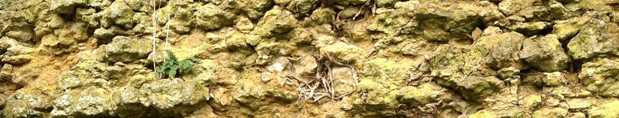
Comparison of deposits at the junction of the Corallian and Kimmeridge Clay Formations.
Abbotsbury – from the Gardens to West Elworth – the iron ore overlays a soft sandstone, and is thought to be the result of a sand deposited very quickly where rapid burial of the sediment isolated it from the oxygenated seawater and produced reducing conditions. The iron in water running from the land therefore precipitated out, collecting round the sand grains.
Sandsfoot – fine clay with iron staining on nodules formed in a quiet lagoon, followed by light grey Kimmeridge Clay.
Ringstead – fine clay overlain by a limestone containing some corals. These must have grown in very shallow oxygenated water with plenty of sunlight. The limestone shows many features indicative of condensation, including an abundant and diverse fauna, evidence of boring, encrustation, and the formation of phosphate nodules and iron ooids. (Coe, 1995) The limestone is immediately followed by dark grey Kimmeridge Clay, full of oyster shells.
These different deposits at the same horizon only short distances apart illustrate the changing environments that existed millions of years ago.
The Corallian Formation below the Iron Ore consists of rhythmic cycles of clay, sand and limestone which reflect relative sea level rises and falls over several million years. The top of the Formination is considered to be the shallow end of the last of these sea level falls. Some of these sands and limestones can be seen south of the village, particularly on Chapel and Linton Hills. The village is built of the best limestone, taken from the medieval quarry at Chapel Coppice, and later quarries on Linton Hill.
The Iron Ore was deposited at a time of flooding as sea level rose over a shallow marine shelf. As the encroaching sea deepened, clay was deposited over the sand. This upper margin of the iron ore is not at present visible in Abbotsbury, though the deposit at Blind Lane S.S.S.I. may be nearer the top.
The Kimmeridge Clay above the Iron Ore is the result of a deep sea deposit where the sea floor was almost entirely without oxygen so that organic matter drifting down from the upper oxygenated water after death has not decomposed fully. The microscopic organic matter has collected together to form potential oil deposits.
This sequence of environments from fluctuating sea levels, through shallow sea, to a deep basin comparable with the Black Sea today, is the subject of intense study. Both oil exploration and the threat of global warming require understanding of the natural changes which have occurred in the past. The tiniest details are needed in order to judge the timing and therefore the speed of these changes. Recent oil exploration has led to understanding of the structural changes which governed the rise and fall of relative sea levels.
The Abbotsbury Fault, which crosses the hillside to the north of Red Lane may have been moving at the time of deposit of the iron ore. The fault movement which occurred at different times and places during the Jurassic was the result of the opening of the north Atlantic and the lateral movement of the Iberian peninsula. Although the iron ore is not specifically mentioned in a recent publication on petroleum geology of the Wessex Basin (Underhill, 1998) , the Abbotsbury Fault figures prominently in that study.
HISTORICAL RECORDS (held in the Dorset County Records Office).
D124 The Ilchester Archive. Box 287. Including map attached.
22.5.1872. Abstract of lease between Earl of Ilchester and Chas. Moore of city of Bath.
“All and sing. the veins beds and deposits of iron ore or ironstone within or lying beneath or under those several closes or parcels of land situate and being in the parish of Abbotsbury Co. Dorset parlarly mentioned and described in the schedule at the foot of the now abstr’g Indre and distinguished and delineated in the map or plan thereof annexed thereto. Together with full and free liberty with agents servants miners and workmen to enter such part of the lands as should for the time being be requisite not exceeding 5 acres at one time without license in writing of the Earl or his Agent for the purpose of searching for working obtaining and winning the said iron ore or ironstone therein before demised first giving notice and making compensation to tenants as therein ment’d.
With power to open shafts to erect sheds and machinery and take away the Iron Ore and Ironstone and make tramroads etc. over the lands described in the schedule and so far as the Earl could grant authority along over and across the inlet of the sea called the Fleet and thence along the Pebble Beach to Portland Harbour as in the now abstracted Indre mentioned. With others powers and subject to certain reservations. To hold from the 25th March 1872 for the term of 40 years thence next ensuing determinable nevless as thinar provided. Yielding and paying during the term a fixed and certain minimum rent of £500 as the rent of the Iron Ore under one acre payable half yearly from entry or if no entry previously from 25th Dec 1872 the 1st years rent to be payable in advance. And the further rent of £500 for every additional acre. And the rent of £5 for every acre of land used for depositing earth, heaps of ore etc.”
Map shows lease of fields at West Elworth, south of main road and all fields around Abbotsbury itself down to Castle Gardens. Field numbers refer to estate map. Also proposed tramway through Elworth and down to beach through water meadows, just east of Wyke Wood. Schedule of land to be leased gives field numbers, names, sizes of holdings and names of tenants. Field 272 is north part of Red Quarry. (Indicates previous working.) There had been negotiations for the previous four years, including discussions on the use of the tramway by the Earl and his tenants.
Suggestion of bridge over Fleet. A leaflet is enclosed on a “Wire rope transport system”.
Letter of 13th Jan 1871 states that best ore has only 30% iron, top part only 20 – 24%, and will be returned to the ground.
5th Nov 1874 Receipt for 2 years rent to Christmas 1874 under Abbotsbury Iron Lease – £1000.
Additions to lease: restore land every 6 months for agricultural use. A provision for allowing more acreage in next year if there is no ore in one year was objected to, with comment “It will be his own fault if he does not get the ore.” Letter 5th August 1872 giving permission for transfer to George Eliot and Stephen Deed. Moore sold the lease to George Eliot 25.10.1872.
PUBLISHED REFERENCES CONCERNING EXPLOITATION OF THE IRON ORE .
References to the building of a railway to convey the ore to South Wales for processing can be found in the Dorset County Chronicle:-
3rd October 1872 (vol. 17 (115) 10). Bridport Railway Co. proposing to build a line for the iron ore recently proved at Abbotsbury.
10th October 1872 (vol. 17 (116) 3). Tramway between Abbotsbury and Upwey station on the Great Western Railway line, to convey iron ore to South Wales, proposed in opposition to Bridport Railway Co.
24th January 1878 (vol. 23 (390) 12). Abbotsbury Railway Co. seeking money from prospective shareholders in Dorchester. Discussion shows that exploitation of the ore was still only a proposition.
The OS map of 1888 shows a tramway built from the Upwey direction, including a branch from Portesham quarry, close to a working marked Shale Works.
The Victoria County History states that iron ore may have been quarried in the medieval period, but there is no documentary evidence.
SCIENTIFIC STUDIES.
BROOKFIELD ME 1971: An alternative to the ‘clastic trap’ interpretation of oolitic ironstone facies. Geological Magazine, 108, 137-43.
BROOKFIELD ME 1973: The palaeoenvironment of the Abbotsbury Ironstone (Upper Jurassic) of Dorset. Palaeontology, 16 (2), 261-74.
BROOKFIELD ME 1973b: The palaeoenvironments of the Upper Oxfordian-Lower Kimmeridgian (Jurassic) sediments in Dorset, England. PhD thesis, Reading University.
BROOKFIELD ME 1974: Palaeogeography of the Upper Oxfordian and Lower Kimmeridgian (Jurassic) in Britain. Palaeogeography, Palaeoclimatology, Palaeoecology, 14, 137-67.
BROOKFIELD ME 1978: The lithostratigraphy of the Upper Oxfordian and Lower Kimmeridgian beds of south Dorset, England. Proceedings of the Geologists’ Association, 89, 1-32.
BROOKFIELD ME 1978a: The use of coarse fraction analysis in palaeoenvironmental interpretation: Upper Oxfordian and Lower Kimmeridgian (Jurassic) sediments in Dorset, England. Sedimentary Geology, 20, (4), 249-80.
COE AL 1995: A comparison of the Oxfordian successions of Dorset, Oxfordshire, and Yorkshire. In Taylor PD, Field geology of the British Jurassic, Geological Society of London, 162.
GROVES TB 1887: The Abbotsbury iron deposits. Proceedings of the Dorset Natural History & Archaeological Field Club, 8, 64-6.
HALLAM A 1975: Jurassic Environments. Cambridge University Press.
HALLAM A 1984: Continental humid and arid zones during the Jurassic and Cretaceous. Palaeogeography, Palaeoclimatology, Palaeoecology, 47, 195-223.
HALLAM A & BRADSHAW MJ 1979: Bituminous shales and oolitic ironstones as indicators of transgressions and regressions. Journal of the Geological Society of London, 136, 157-64.
KNOX RW0’B 1971: An alternative to the ‘clastic trap’ interpretation of oolitic ironstone facies. Geological Magazine, 108 (6), 544-5.
LAMPLUGH GW, WEDD CB & PRINGLE J 1920: Iron Ores: bedded ores of the Lias, Oolites and later formations. Memoir of the Geological Survey of Great Britain. Resources Report, 12, 222.
MOOREHEAD Dr. 1887: Abbotsbury Iron Ore. Proceedings of Dorset Natural History and ArchaeologicalField Club, 8, xliv.
OAKLEY KP 1943: Iron Age A pottery at Quarry Lodden & Maiden Castle. Possible use of haematite slip from Abbotsbury Iron Ore. In Wheeler R.E.M. Proceedings of Dorset Natural History and Archaeological Society, 93, 138, 143 & 379-80.
SANDY MR 1985: Brachiopods from the Jurassic Abbotsbury Ironstone, Abbotsbury. Proceedings of Dorset Natural History and Archaeological Society, 106, 171.
UNDERHILL JR 1998: Development, Evolution and Petroleum Geology of the Wessex Basin. Geological Society of London, Special Publication no. 133.
(Compiled by Jo Thomas, 5.7.1999. D.I.G.S.)
One thought on “Abbotsbury”
Comments are closed.